Watch Out Above - Avalanche Risk in Washington
Avalanche Danger in the High Country
Snow is in the forecast and more Washingtonians than ever are enjoying our state’s diverse winter recreation opportunities. However, before you head out, it is critically important that you understand the avalanche risk and take appropriate precautions. Just in the last two weeks, one person died and eight people were caught in three separate avalanches in Washington State: one near Salmon La Sac, one on Snoqualmie Pass, and one on Stevens Pass.

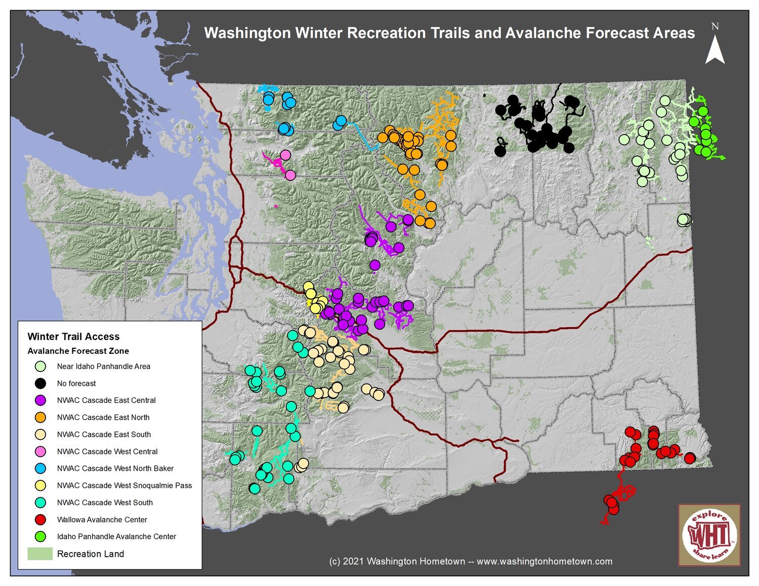
Washington State is covered by three different avalanche centers. The Northwest Avalanche Center (NWAC) provides forecasts for the Cascades and Olympic Mountains, with their coverage divided into 10 separate regions. The SE corner of the state is adjacent to the area covered by the Wallowa Avalanche Center (WAC) and the very NE corner of the state is close to the region served by the Idaho Panhandle Avalanche Center (IPAC). The central part of Washington State, including the Methow Valley and Colville National Forest, is not covered—but that does not mean that there is no avalanche risk in those areas.
Before you go out, check conditions and make sure you are prepared and have the equipment you need.

Make sure you:
Check the avalanche forecast before you head out. Avalanche risk can vary significantly depending on the weather and snow conditions.
Check that everyone in your party has the appropriate equipment if you are going into the back country: a transceiver to broadcast your location to your party if you get buried, a probe that can be used to find victims, and a shovel for the rescue.
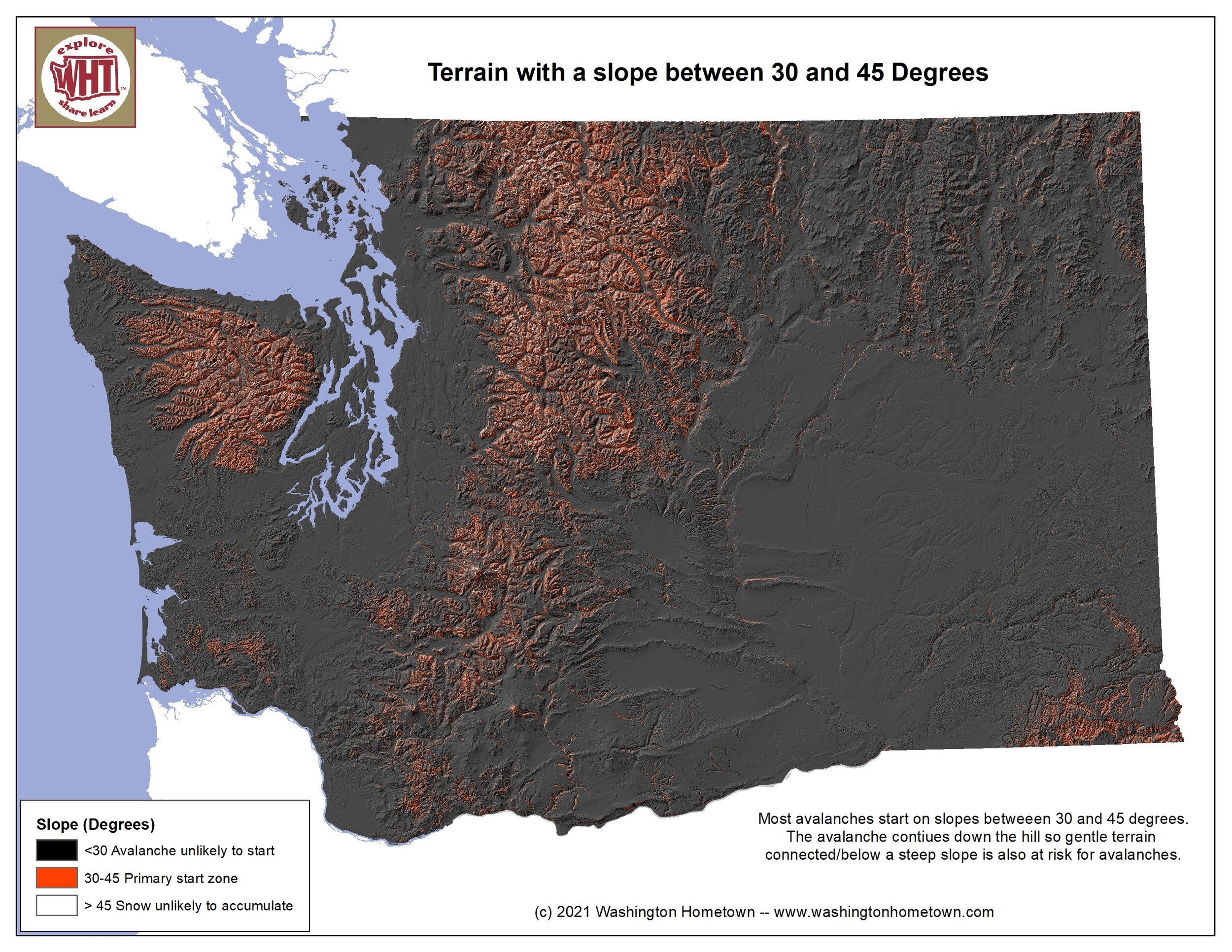
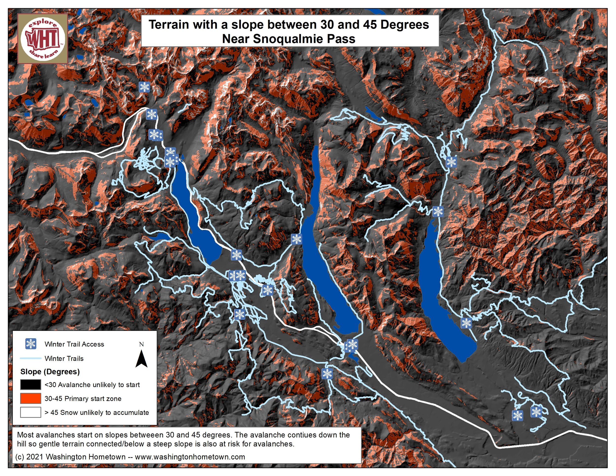
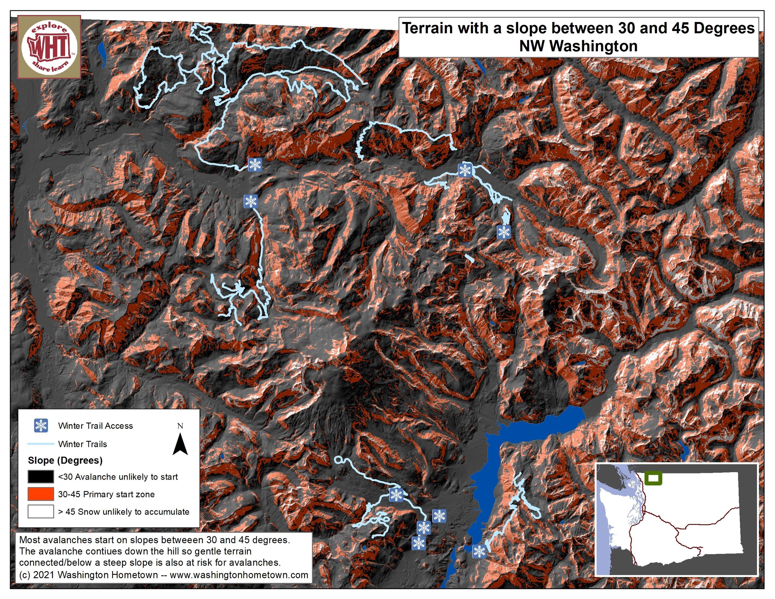
Keep an eye out for signs of danger—including steep slopes and landscape signs such as missing trees below tree line or broken branches that can indicate an avalanche chute. Keep in mind that, although most avalanches start on slopes between 30 and 45 degrees, the avalanche will continue down across more gentle slopes so you need to be aware of not just the terrain you are on but what is above you.
For more information on Avalanche safety:
Check out the NWAC’s e-learning series on backcountry basics including information on gear, training, forecasting, avalanche training, and next steps that you need to be aware of before heading out into the mountains in the winter.
Sign up for NWAC’s basic, intermediate, and advanced training.
Check out REI’s page on recognizing avalanche terrain.
Check out the Snow NW web map for all winter recreation opportunities or the Snowmobile NW web map and app for snowmobile opportunities.
Each winter recreation trail and point on Northwest Portal’s Snow NW and Snowmobile NW maps includes a link to the avalanche center serving that area or to the general Northwest Avalanche Center Page for places not covered by a forecast region.